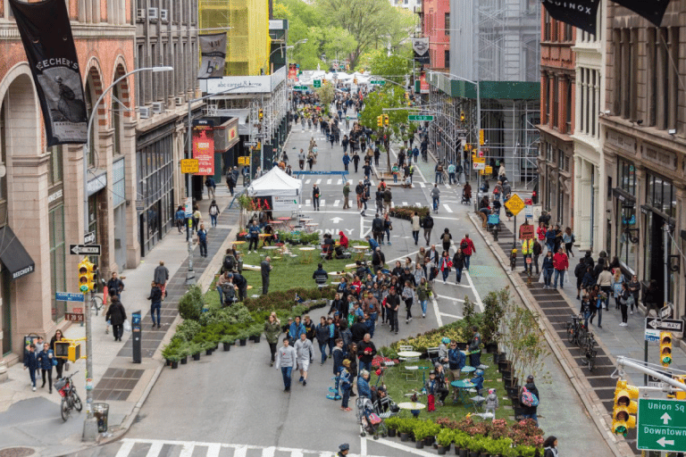
This summer New York City will further expand the perimeter of its car-free streets, bringing the “Summer Streets” initiative to involve all five boroughs. For the 2025 edition, the city’s Department of Transportation has released an interactive map that allows precise tracking of routes and points of interest along the nearly 400 blocks that will be closed to traffic on several days between July and August. What’s new is not only the size, but also the ability for the first time to walk across Manhattan from the Brooklyn Bridge to Dyckman Street at the top of the island without crossing cars.
The initiative, born in 2008, is inspired by similar programs in other cities-most notably Bogotá, which has organized the weekly “Ciclovía” since the 1970s-and is designed to provide spaces for socializing, sports and culture in normally congested areas. In New York, success has grown year by year: in previous editions it focused almost exclusively on Manhattan, while this year it also includes less touristy neighborhoods such as Staten Island or sections of the Bronx and Queens. This expansion is in response to requests from local residents and associations who have long called for the project to be taken out of downtown.
The digital map released by the municipality, in addition to showing the various pardon routes, also shows rest areas with events, music, free water or gadget distributions, art installations, and areas to try out Citi Bikes for free. The schedule changes from district to district and from date to date, which is why the online tool has become essential for those who want to plan ahead. Access to the activities is free and the initiative takes place in all weather conditions, from 7 a.m. to 3 p.m.
The dates set for 2025 are July 26 for Queens and Staten Island, August 2, 9, and 16 for Manhattan, and August 23 for Brooklyn and the Bronx. The formula is designed to spread out the flows of people and reduce impacts on ordinary traffic: each Saturday involves only two boroughs, also allowing police and city departments to better manage closures and detours. Free Citi Bike use on Summer Streets days, made possible by a partnership with Lyft, is one of the incentives introduced to push residents to leave their cars at home.
The article An interactive map to orient yourself during Summer Streets 2025 comes from TheNewyorker.